
NearSafe: see what’s reported near you in Houston, Dallas and other Texas cities
NearSafe is a free community safety map from GrtLabs. It shows official police open data at block level, never an exact address, with the source and license for each city listed on the map.
It is now piloting in four Texas cities: Houston, Dallas, Arlington and San Antonio. San Antonio shows 911 calls for service, not confirmed crimes, and the map labels it that way.
The records come from public city sources published by each police department. They may be wrong or out of date. NearSafe is not a safety rating, and it does not guarantee that a place is safe or unsafe. It is not for emergencies. If you need emergency help, call 911.
For people in Houston and Dallas
The map opens to your nearest pilot city (Houston by default). Tap Near me to jump to your area. NearSafe uses your browser location only after you tap that button, and it does not store, log or send your coordinates to NearSafe.
Houston uses published Houston Police Department files. Dallas uses Dallas Police Department open data. The Data sources page in the app lists each city’s current date range, last refresh and license.

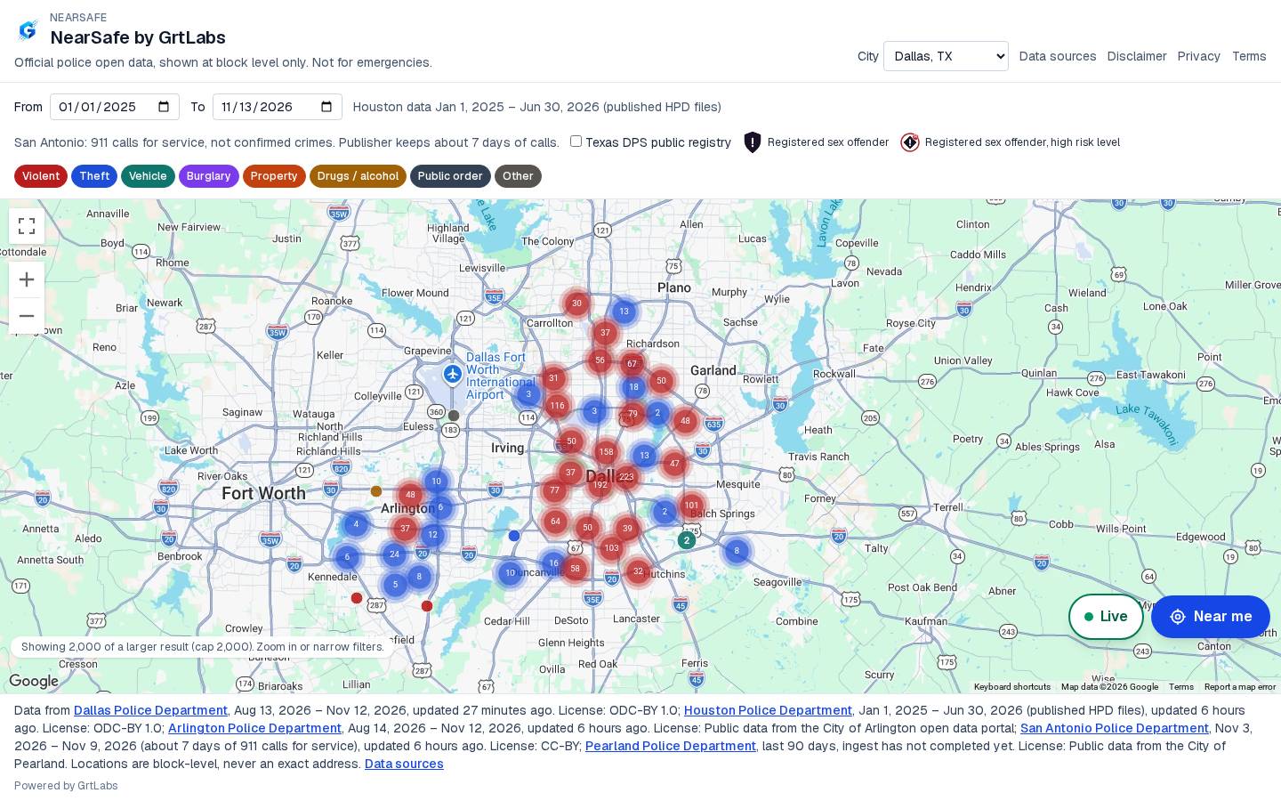
Which cities have data loaded
These four cities have data loaded in the app today. Check the Data sources page for current date ranges, because those ranges change as each publisher updates its files:
- Houston, TX — Houston Police Department open data, from published HPD files.
- Dallas, TX — Dallas Police Department open data.
- Arlington, TX — Arlington Police Department open data, from the City of Arlington open data portal.
- San Antonio, TX — San Antonio Police Department 911 calls for service, not confirmed crimes. The publisher keeps about seven days of calls. Traffic and other published call types are included, and the map labels this feed.
Pearland appears in the city list, but as of November 13, 2026, its data ingest had not completed yet. Do not treat Pearland as a city with loaded data until the Data sources page says otherwise.
How the map works
- Pick a city, then zoom and pan the map. Two-finger zoom and pan are supported.
- Filter by date and by type, including violent, theft, vehicle, burglary, property, drugs / alcohol, public order and other.
- Use the Near me button to jump to your area after you allow location access in the browser.
- Open Data sources for every city’s publisher, license and date range.
A NearSafe mobile app is coming soon. The map is free to use in the browser at nearsafe.grtlabs.com.
Where the data comes from
NearSafe does not invent these records. It shows official open data published by each city’s police department (and, for San Antonio, published 911 calls for service). Locations are drawn at block level, never as an exact address. Sources, licenses and refresh times are listed on the map footer and on the Data sources page.
What NearSafe does not do
- It is not for emergencies. Call 911 if you need help.
- It does not show exact addresses. Map locations are approximate.
- It does not grade neighborhoods or guarantee safety. Records may be wrong or out of date.
- It does not store your location.
Using this information to harass someone can bring criminal charges or a lawsuit. Read the app’s disclaimer, privacy and terms.
Frequently asked questions
What is NearSafe?
NearSafe is a free community safety map from GrtLabs. It shows official police open data at block level, never an exact address, with the source and license for each city listed on the map.
Which cities does NearSafe cover?
Data is currently loaded for four Texas cities: Houston, Dallas, Arlington and San Antonio. San Antonio shows 911 calls for service, not confirmed crimes. Pearland appears in the city list, but as of November 13, 2026, its data ingest had not completed yet. Check the Data sources page for the current status.
Where does the data come from?
From public city sources: Houston Police Department, Dallas Police Department, Arlington Police Department and San Antonio Police Department. Each city’s date range, license and last refresh are listed on the Data sources page at nearsafe.grtlabs.com/sources.
Does NearSafe show exact addresses?
No. Locations are shown at block level only. They are approximate, never an exact address.
Is NearSafe a guarantee of safety?
No. NearSafe is not a safety rating and it does not guarantee that a place is safe or unsafe. Records may be wrong or out of date.
Is NearSafe for emergencies?
No. NearSafe is not for emergencies. If you need emergency help, call 911.
How does the Near me button work?
The map opens to your nearest pilot city (Houston by default). Near me uses the browser geolocation API only after you tap it. NearSafe does not store, log or send your coordinates.
Is NearSafe free? Is there a mobile app?
The map is free to use in the browser at nearsafe.grtlabs.com. A NearSafe mobile app is coming soon.
Does NearSafe include the Texas sex offender registry?
The app can show a layer from the Texas Department of Public Safety public sex offender registry. It is off unless you turn it on. The Data sources page states that records may be wrong or out of date, that only fingerprints positively identify someone, that not every offender is on the public list, that map locations may be inaccurate, and that using this information to harass someone can bring criminal charges or a lawsuit. To report errors, contact local law enforcement, or use the Texas DPS registry and NSOPW. NearSafe does not scrape those sites.
Built by GrtLabs
NearSafe is built by GrtLabs Inc, a Houston software company founded in 2019. See all GrtLabs apps, or contact us.